
Fourknocks Passage Tombs: Excavation Reports
Excavation reports for the Fourknocks passage tombs in County Meath by P.J. Hartnett, covering Fourknocks I (1957) and sites II and III (1971).
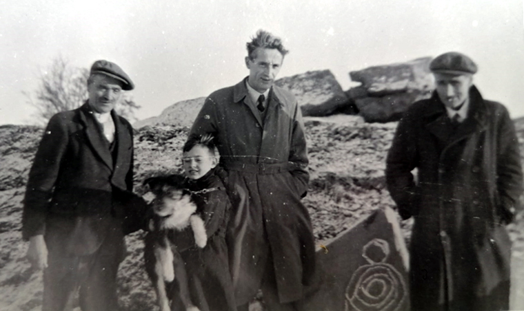 P.J. Hartnett who excavated Fourknocks (centre of photo), 1950.
Fourknocks I Excavation Report
Excavation of a Passage Grave at Fourknocks, County Meath by P.J. Hartnett, 1957.
The Delvin stream has its source in Garristown Hill, Co. Dublin, and flows in a north-easterly direction to enter the Irish Sea at Gormanston on the Dublin Meath border. For most of its fifteen miles' course it forms the boundary between counties Dublin and Meath. To the north and south of it are long, east-west, saddle-backed ridges sometimes rising to over 500' O.D.
Numerous mounds and other earthworks, the majority of them hitherto unrecorded, are sited on these ridges on both sides of the Delvin valley. On one such ridge in the townland of Fourknocks, Co. Meath, are three barrows or mounds, one of which, Fourknocks I, the subject of this paper, was excavated in the autumn of 1950 and was found to cover an undisturbed passage grave. A second mound, Fourknocks II, occupying slightly higher ground 50 metres east of No. I, was partly excavated in 1951. This and the remaining mound, Fourknocks III, were completely excavated in 1952.
Attention was first drawn to the Fourknocks area by Mrs. Liam O'Sullivan of Dublin, whose uncle, Mr. Patrick Maguire, an enthusiastic antiquary, lives at Snowtown, Naul. In August, 1949, Mr. Maguire brought the writer to see sites on his own land at Naul, and on the land of Mr. Thomas Connell at Fourknocks. The first of the Fourknocks sites was a rather insignificant mound, much overgrown with brambles and rank grass. A funnel-shaped pit dug into its west side, said to have been made towards the close of the last century by treasure seekers, invited closer attention.
With the assistance of Mr. Maguire some of the overgrowth was cleared to reveal, about 1 metre below the surface, a large flat slab partly embedded in the sides of the pit. On the exposed eastern edge, very definite grooves could be felt, which on closer inspection were found to form a chevron and lozenge pattern.
In the circumstances a more thorough examination of the site was called for, and for this the permission of the landowner was generously accorded. The project had the approval of the Archaeological Exploration Committee of the Royal Irish Academy, and with moneys provided from a State grant administered by the Special Employment Schemes Office the site was completely excavated during the period of nine weeks following September 11, 1950.
A certain amount of restoration work had to be done, re-setting of orthostats and securing in concrete where necessary and the soil replaced and re-sodded to a height of 3 metres in anticipation of future conservation by the National Monuments Branch of the Office of Public Works. In deciding the limits of the restored mound, the encircling kerb of stones on old ground level was followed. All the finds from this excavation have been acquired for the National Museum.
Fourknocks I Excavation Report (29 MB PDF).
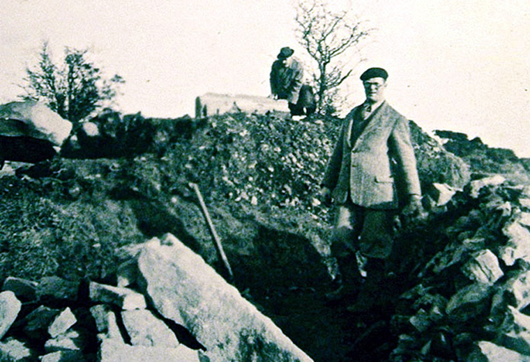 Excavations at Fourknocks, 1950.
Fourknocks II and III Excavation Report
The excavation of two tumuli at Fourknocks (sites II and III), County Meath by P. J. Hartnett, communicated by G. Eogan. Published by the Royal Irish Academy 1971.
Site II During the Neolithic period Passage Grave builders constructed an ovoid tumulus that measured 28m by 24m and around 4m in height. The tumulus, surrounded by a ditch, covered two separate monuments: a bell shaped cairn and a megalithic passage with a trench placed transversely to it. The passage and trench were used for human burial. During the Early Bronze Age the site had a secondary use; at that time burials, some of them in cists, were inserted into the tumulus.
On the south-western side of the site a hoard of Hiberno-Norse coins was discovered. In fairly modern times a lime-kiln was built into the edge of the mound on the northern side.
Site III This was a small tumulus about 13m in diameter and 2m in height, composed of layers of sod, clay and stones. It covered a central pit that contained some cremated human bone. High up in the mound a food vessel and an urn were found. The latter contained the cremated remains of a young child.
Fourknocks II and III Excavation Report (22 MB PDF).
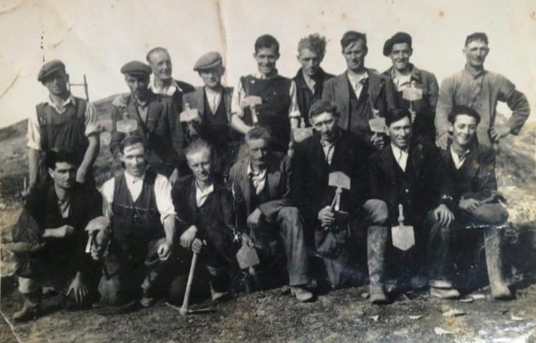 Excavations at Fourknocks, 1950.
More on Fourknocks and Fourknocks images.